Civil Engineering
One of the recurrent problems encountered in the reading of the
history of science goes beyond the neglect of Islamic
contribution, and that is the systematic taking away of such
accomplishments from the Muslims as is the case here. Smith
notes, indeed, how irrigation technologies found in Spain were
acknowledged to be of Islamic origins until 1864, when the
French historian, Aymard, in his Irrigations du Midi et de
l’Espagne, denied any such Islamic role, and was followed by
others, who built on his legacy to attribute such skills to post
Muslim Spain.[1]
This has become a generalised practice amongst Western
historians in their treatment of almost every single Islamic
accomplishment.
Halpern has noted how many of the once great achievements of
Muslim civilisation are taken away from the Muslims one after
the other.[2]
The dominant practice has been for historians to complement each
other in the suppression of the Islamic legacy established by
earlier authorities, and this has affected literally every
aspect of the sciences and civilisation. Hence, in relation to
chemistry, the 18th century historian Gibbon declared
that the science of chemistry owes its origin and importance to
the industry of ‘the Saracens’,
‘They first invented and named the alembic for the
purpose of distillation, analysed the
substances of the three kingdoms of nature, tried the
distinction and affinities of alcalis and acids, and converted
the poisonous minerals into soft and salutary medicines.’[3]
Yet a century after Gibbon the originality of the Muslims in all
these respects had been considerably diminished. Berthelot (and
his countless followers) denied them any significant
contribution in this field, ascribing rather to Western
alchemists whatever advances were made in the Middle Ages.[4]
Equally, the Gothic style was amply demonstrated by Christopher
Wren in the 17th century to be of ‘Saracen’
authorship, at a time, when Gothic was identified with the
barbaric,[5]
and yet, today, hardly any modern historian sees anything
Islamic in such style. The same with regard to the Arabic
numerals, once shunned,[6]
regarded even as a symbol of ‘Saracen magic,’[7]
then, as they became the foundation of modern civilisation, and
though a gradual re-working by modern historians, these numerals
are no longer called Arabic, and hardly any modern historian
fails to call them Hindu, or even attribute their origins to
Western sources.[8]
Experimentation, and the experimental method were viewed in the
Western Middle Ages as dabbling with the occult, any person who
performed experiments or made astronomical observations soon
incurring the suspicion that he carried on forbidden intercourse
with the world of demons.[9]
Gradually, again, in modern historian interpretations,
experimentation becomes a purely Western creation, regardless of
the evidence.[10]
And the list can go on endlessly, how each modern historian,
building on his predecessor, removes more traces of the Islamic
role, until any Islamic role is fundamentally erased from nearly
all disciplines and aspects of civilisation.
In respect to hydraulic technologies developed in
‘Where did the conquering Christians learn such skills more
advanced than found anywhere else in
Had such re-conquering Christians come from parts or regions
where there existed a great expertise and established tradition
in such technologies, one would accept it. But this is not the
case at all. Historical evidence shows that the most advanced
medieval dams in any part of the West were in
Secondly, it makes no sense that Westerners formerly plunged in
utmost darkness suddenly, out of nowhere, in the 12th-13th
centuries discovered all these skills, it seems by a miracle.
Thirdly, and more importantly, as will be demonstrated in the
following, hydraulic
technologies, like other civil engineering skills, were a
widespread art throughout the vast
Dams
Dams
, according to Smith, ‘not only represent some of the most
impressive achievements of engineers over the centuries, but
their vital role in supplying water to towns and cities,
irrigating dry lands, providing a source of power and
controlling floods is more than sufficient to rank dam building
amongst the most essential aspects of man’s attempt to harness,
control and improve his environment.’[12]
In Muslim Spain and
Contrary to historians’ assertions, Hill points out, there was
no decline in engineering activities, including dam
construction, in Muslim times.[18]
On the contrary, Hill insists, the new irrigation systems and
the extension of existing ones (as described under agriculture)
necessitated the construction of a large number of dams, many of
which were small diversion dams, but several were large.[19]
Whether in the eastern or western parts of the realm, Muslim
engineers were responsible for accomplishments in the field that
surpassed anything seen before.
The majority of the earliest Islamic dams were completed
in
Further east, in today’s Afghanistan, three dams were completed
by King Mahmoud of Ghaznah (998-1030) near his capital city, one
of which named after him, was located 100 km SW of Kabul, and
was remarkable for its dimensions, 32m high, and 220m long.[29]
In Muslim Spain, Smith notes, a conscious attempt was made to
recreate in
Smith focuses on the Muslim use of sophisticated land surveying
methods to locate their dams in the most suitable sites, and
also to lay out very complex canal systems feeding into, and out
of them.[37]
Hill, for his part, extols most particularly Islamic techniques
in desilting sluices, gauging rivers, design and location, all
aiming for the structure to last as can be seen in Valencia
, Cordoba
and Murcia today.[38]
The Muslim ability to gauge a river and then design the dams and
canals to match, as seen on the river Turia in
‘Stand at the bank of the river and hold the astrolabe in your
right hand and look through the hole of the eye piece with one
of your eyes, raise the level of the Alidade and look towards
the opposite bank. Keeping the alidade in the same position,
look towards the ground. Note the point thus obtained. The
difference between these points will give the width of the
river.’[40]
The dams erected by the Muslims prove the innovative, pioneering
Islamic engineering ingenuity in the field. Many structures all
over the Islamic world are witness to this. In the East,
Schnitter notes that, with the exception of the Qusaybah dam
near Madinah, a 30 m high-205 m long structure, which was
slightly curved in plan, the alignment of all others was
straight.[41]
About half such dams were provided with a flood overflow at one
end, and often with a downstream training wall to guide the
spilled water to a safe distance from the dam’s foot. Schnitter
also observes that about a third of such very early dams (7th-8th
century) were still intact.[42]
In some cases dams were built with carefully cut stone blocks,
joined together by iron dowels; the holes in which the dowels
fitted were filled by pouring in molten lead.[43]
The result was an impressive structure of masonry such as the
dam at Marib in
In
In the Maghrib
the most original
reservoirs of all are found at Al-Qayrawan
in
Bridges
Diversity in landscapes and local conditions imposed a wide
variety of designs and techniques in bridge construction; each
bridge being constructed according to its own topographic
setting.
Pontoon bridges were common, quick to assemble and highly
practical.[68]
Many Muslim towns such as
Bridges of boats were not common in medieval Europe, but some
were built, the first
Stone bridges were also constructed in large numbers, and were
innovative in their
architecture. In
Suspension bridges were used to cross ravines in hilly
countries. In the 10th century, Ibn Hawqal describes how the
river Tab in
The Islamic dominance in the field is noted by Hill, who
observes that in non-Islamic Europe no bridges of note were
built between the end of the
Canals, Qanats,
and Surveying
Canals served for irrigation, transport and urban supply of
water throughout the Islamic world. In the south of
Further north,
The qanat system, as seen above (under agriculture), was also
widely diffused by the Muslims for both irrigation and urban
water supply.[104]
The word ‘qanat' in Arabic, Pacey explains, is said to be the
same of the English word ‘canal' which was initially used to
mean a pipe, or tunnel carrying liquid.[105]
It consists, primarily, in tapping deep ground water without the
use of lifting devices, but by sinking a series of wells and
linking them underground.[106]
The vertical shafts constructed along the line of the qanat
allow access for maintenance and removal of spoil.[107]
The shortest and best outline on the construction of a qanat is
provided by Crowe et al. It says:
‘The
construction of a qanat makes a fascinating study. When a
particular source of water is located, say at the foot of a
mountain, a vertical master shaft is dug or drilled to the level
of the water, which may vary considerably but does not usually
exceed about 150 feet. The depth of the level of the water below
ground is then gauged and the position of the outfall on a
horizontal line is estimated by means of a series of horizontal
alignments and drops along the surface. A line is then drawn
between the master shaft and the point of outfall, and thence to
the point where the water is to be used. This establishes the
course of the qanat.
Following this line, a series of further vertical shafts is
drilled, each at a distance of twenty or thirty yards apart
along this line, to such a depth as to be in horizontal
alignment with the level of water at the base of the master
shaft. Finally, from the bottom of each shaft a tunnel is
excavated to connect each length to the next, so as to extend
from the outfall back to the source of water. Ultimately, a
breakthrough is made on the last section, so that the water
flows along the whole of the tunnel, discharging at the outfall.
Here it is usually conducted into a channel, from which it is
put to various uses. Normally, the horizontal tunnel is bored
through the formation strata without support, but if the ground
is exceptionally shaly or liable to subsidence, it may be
necessary to line the excavation with brick, wood or tile. The
tunnel is usually four to five feet in diameter.
Many
qanats terminate in a tank or cistern from which water supplies
for further uses may be drawn. But more commonly the water is
conducted from enclosure to enclosure by straightforward gravity
feed. Highly reticulated systems of waterways
are built up until every drop is drained and used up.’[108]
The Muslims refined the technique by using all known methods of
mathematical calculation and engineering that had then become
known to them.[109]
Qanats were widely used through the Muslim land, from the Middle
East to North Africa
, to
the
Throughout the centuries, the Islamic
qanat system spread widely, stretching from the Castilian Meseta
(
The
success of such civil engineering projects owes to large extent
to the advance in related scientific literature. Al-Kharaji (11th
cent) treatise Inbat al-miyah al-khafiyya (The Extraction
of Hidden Waters), for instance, deals with quantity surveying,
that is, how to calculate the quantities of excavations for
canals and hence derive the cost of the works in labour and in
money. It, most importantly,
describes instruments used by master well diggers and qanat
builders, as well as methods of detecting sources of water and
instructions for the excavation of underground conduits.[118]
It includes some very interesting chapters: Chapter 17, for
instance, deals with the manner and methods of resolving
physical obstacles hampering tunnelling of the ground. Chapter
18 covers the manner of water adduction by the means of
conduits. Chapter 19 has recipes for sealing joints of conduits.
Chapter 23 covers instruments for the purpose of civil
engineering invented by himself (al-Kharaji). Chapter 25
explains how to construct an underground qanat, whilst chapter
26 tells how to maintain the horizontality of a tunnel at both
ends of the qanat. Chapter 28 deals with the management of the
qanat, and chapter 30 covers the specific rules and clauses that
must be included in a contract with an underground tunnel
digger.[119]
There is also
from
Equally revealing are Ibn al-Awwam’s observations on levelling
works to be undertaken before opening up canals, and Ibn Lujun
of Almeira (14th century) studies on land levelling
for the purpose of canal digging.[124]
Further information on studies of Muslim techniques of land
levelling can be extrapolated from Wiedemann.[125]
Muslim engineers also used triangulation techniques for the
purpose of determining the heights and depths of objects, and
the widths of obstacles such as large rivers by using the back
of the astrolabe.[126]
Al-Biruni
(d. 1050) and the
Spanish Muslim, Ibn al-Saffar (d. 1035), describe the solution
of various triangulation problems using the astrolabe.[127]
Many other problems are also solved by similar means, and they
include finding the distance between two points separated by an
impassable obstruction.[128]
Al-Kharaji devotes chapter 24 of his above mentioned work
to an instrument for calculating the height of a mountain; the
distance from it, or the height of any visible
Generally, Muslim science and practical knowledge in this
subject passed intact to the Christian West, and generally via
‘And so you may irrigate with them (the canals) and take waters
without obligation, service or tribute; and you shall take these
waters, as was established of old and was customary in the times
of the Saracens.’[130]
[1]
N. Smith: Man and Water
; A History of Hydro Technology
(Peter Davies;
London; 1975), p. 19.
[2]
L. Halpern: l’Essor de l’Europe (XI-XIII Siecles)
(Presses Universitaires de France; Paris; 1941); p. 101.
[3]
In C.H. Haskins: The Renaissance of the Twelfth
Century; op cit. pp. 319-20.
[4]
Ibid. p. 320.
[5]
J. Sweetman: The Oriental
Obsession
(Cambridge
University Press, 1987), p.6.
[6]
D.J. Struik: The Prohibition of the use of Arabic
numerals in
[7]
William of Malmesbury: History of the kings of
[8]
See H.P. Lattin: The Origin of our present system of
notation according to the theories of Nicholas Bubnov.
In ISIS; XIX; pp. 181-94; at p. 182.
[9]
E.J. Dijksterhuis: The Mechanization of the World
Picture (Oxford at the Clarendon Press; 1961),
p.104.
[10]
A.C
Crombie: Robert Grossesteste;
op cit
[11]
See:
N.J. Schnitter: A History of Dams
(A.A. Balkema,
Rotterdam, 1994).
N. Smith: A History of Dams
;
op cit.
[12]
N. Smith: A History; op cit, preface, p.i.
[13]
A.M. Watson: Agricultural; op cit p. 104.
[14]
Le Strange: The Lands of the Eastern Caliphate (
[15]
A.M. Watson: Agricultural; op cit; p. 160.
[16]
N. Smith: A History, op cit, p. 81.
[17]
N. Smith: Man and Water
; op cit; p. 21.
[18]
D.R. Hill: A History of Engineering; op cit; p.
57.
[19]
Ibid.
[20]
N.J. Schnitter: A History of Dams
; op cit.
[21]
N. Smith: A History of Dams
, op cit, p.78.
[22]
D.R. Hill: A History of Engineering; op cit; p.
57.
[23]
N. Smith: Man and Water
;
op cit; p. 16.
[24]
Ibid.
[25]
D.R. Hill: A History of Engineering; op cit; p.
24.
[26]
N. Smith: Man and Water
; op cit; p. 16.
[27]
Ibn Sarabiyun (Ibn Serapion): Kitab Ajaib al-Aqalim
al-Sab’a; ed H. Von M’zik (
[28]
N. Smith: Man and Water
; op cit; p. 17.
[29]
N. Schnitter: A History, op cit, pp 88-9.
[30]
N. Smith: Man and Water
; op cit; p. 21.
[31]
Ibid.
[32]
Ibid.
[33]
N. Smith: A History; op cit; p. 108.
[34]
In D.R. Hill: Islamic Science, op cit, p.161.
[35]
Ibid.
[36]
N. Smith: Man and Water
;
op cit; p. 21.
[37]
N. Smith: A History, op cit, p. 88.
[38]
D.R. Hill: Islamic Science; op cit; p. 161.
[39]
Ibid.
[40]
Anonymous: Risala fi Alat al-rasad; Ms. 68.
[41]
N. J. Schnitter: A History of Dams
; op cit; pp-81-2.
[42]
Ibid; p.
82.
[43]
A. Pacey: Technology
;
op cit; pp.9-10.
[44]
D. Hill: Islamic Science, op cit, at p. 159.
[45]
Ibid.
[46]
D.R. Hill: A History of Engineering; op cit; p.
57.
[47]
D.R. Hill: Islamic Science, op cit; p. 168.
[48]
N. Smith: A History; op cit; D.R. Hill:
Islamic Science, op cit.
[49]
N. Smith: A History; op cit; p. 108.
[50]
S.P. Scott, History;
op cit; vol 2;
at pp. 601-2.
[51]
Ibid; p. 602.
[52]
N. Smith: A History, op cit, p. 93.
[53]
Ibid.
[54]
N. Smith: A History; op cit, pp. 94-7; D. Hill:
Islamic Science, op cit, pp. 166-7.
[55]
Ibid.
[56]
Ibid.
[57]
M.Shaw: Voyages de Shaw MD dans plusieurs provinces
de la Barbarie et du Levant; 2 Vols (La Haye, 1743),
Vol II; pp
257-9; and E. Pelissier: Description de la Regence de
Tunis
; Exploration scientifique de l’Algerie pendant les
annees 1840-41-42
(Paris, 1853), pp 279-280.
[58]A.
Daux: Recherches sur l’originalite et l’emplacement
des emporia Pheniciennes dans le Zeugis et le Byzacium
(Paris, 1849).
[59]H.
Saladdin: Enquetes sur les installations hydrauliques
romaines en Tunisie, published by Direction des
Antiquites et Beaux Arts
, et La regence de Tunisie (Tunis
, 1890 a 1912).
R. Thouvenot: Les traveaux hydrauliques des Romains en
Afrique du Nord in: Realites marocaines, Hydraulique,
Electricite (Casablanca, 1951).
[60]
P. Gauckler: Enquete sur les Installations
hydrauliques Romaines en Tunisie; 2 Vols (Paris;
1901-2).
[61]
A. Solignac: Recherches sur les installations
hydrauliques de kairaouan et des Steppes Tunisiennes du
VII au Xiem siecle, in Annales de l’Institut des Etudes
Orientales, Algiers
, X (1952); 5-273.
[62]
Ibid.
[63]
Ibid.
[64]
Ibid.
[65]
In D.R. Hill: A History of Engineering; op cit;
p. 45.
[66]
Ibid.
[67]
K.A. C. Cresswell: A Short Account Early Islamic
Architecture
(Penguin Books;
London; 1958), pp. 291-2.
[68]
Accounts on pontoon bridges in D. R. Hill: Islamic
Science, op cit; at pp 154-5; and ‘Engineering' in
Encyclopaedia (Rashed ed) op cit; at p 763.
[69]
Ibn Hawqal: Kitab Surat al-Ard; op cit; p. 241.
[70]
Al-Istakhri: Kitab al-masalik; op cit; p. 39.
[71]
Al-Idrisi: Description de l’Afrique et de l’Espagne;
Arabic text with Fr trans by R. Dozy and M.J. de Goeje
(Brill; Leiden; 1866), p. 142 Arabic.
P. 171 Fr.
[72]
Ibn Jubayr
: Rihla; Arabic text ed by W. Wright (
[73]
Ibid; p. 217.
[74]
Al-Istakhri: Kitab al-Masalik; op cit; p. 62.
[75]
Ibid; p. 141.
[76]
G. Wiet et al: History; op cit; p. 323.
[77]
Ibid.
[78]
D. Hill: Islamic Science; op cit.
[79]
W. B. Parsons: Engineers and Engineering in the
Renaissance; 2nd ed (MIT Press;
Cambridge, Mass; 1968), p. 89.
[80]
G. Wiet et al: History; op cit; p. 323.
[81]
D.R. Hill: A History of Engineering; op cit; p.
71.
[82]
Al-Istakhri: Kitab al-Masalik; op cit; p. 91.
[83]
Ibid.
[84]
Ibn Jubayr
: Rihla; op cit; pp. 214-5.
[85]
Ibid.
[86]
Ibn Jubayr
: Rihla; op cit; in D. R. Hill: History of
Engineering; op cit; note 27; p. 74.
[87]
Al-Qazwini: Athar al-Bilad was Akhbar al-Ibad (
[88]
Ibid.
[89]
D.R. Hill: Islamic Science; op cit; pp. 155-6.
[90]
Ibid.
[91]
D. Hill: Engineering,
op cit, p. 762.
[92]
Ibid.
[93]
D.R. Hill: A History of Engineering; op cit; p. 71.
[94]
Ibid.
[95]
Ibid; p. 24.
[96]
Ibid; p. 25.
[97]
Raf van Laere: Techniques Hydrauliques en Mesopotamie
Ancienne; Orientalia Lovaniensa Periodica
(University of Leuven Press; 11; 1980), pp. 11-53; p.
22.
[98]
D.R. Hill: A History of Engineering; op cit; p.
24.
[99]
Ibid.
[100]
I.M. Lapidus:
[101]
Al-Muqaddasi: Ahsan al-Taqasim; (De Goeje ed) op
cit; p. 74.
[102]
M. Brett: Marrakech
in Dictionary
of the Middle Ages; op cit; vol 8; pp 150-1.
[103]
Editor: Ma’ (irrigation in North Africa
and
[104]
T. Glick: Islamic, op cit, p. 226.
[105]
A. Pacey: Qanats; in Encyclopaedia (Selin edt) op
cit; p. 832.
[106]
T. Glick: Islamic, op cit, p. 226.
[107]
K. Sutton: Qanats in al-Andalus;
op cit;
p. 70.
[108]
S. Crowe et al: The Gardens
of Mughal India
(Thames and
Hudson; London; 1972), p. 32.
[109]
A.M. Watson: Agricultural, op cit, p. 107.
[110]
D.R. Hill: A History of Engineering; op cit; p.
36.
[111]
Ibid.
[112]
Al-Istakhri: Kitab al-masalik; op cit; p. 122.
[113]
Ibn Hawqal: Kitab
[114]
L. Bolens: Irrigation, in Encyclopaedia (Selin
ed), op cit, p. 452.
[115]
J.C. Wilkinson: The Organization of the Falaj
Irrigation System in
[116]
S. Crowe et al: The Gardens
of Mughal India
; op cit; p. 32.
[117]
L. Bolens: Irrigation, in Encyclopaedia (Selin
ed), op cit, p. 452.
[119]
A. Mazaheri: Le Traite; op cit; pp. 300-1.
[120]
D.R. Hill: Islamic Science, pp 187-91.
[121]
Ibid; p. 187.
[122]
Description and use can be found in D.R. Hill: A
History of Engineering; op cit; pp. 117-9.
[123]
Ibid; p. 117.
[125]
E. Wiedemann: Beitrage zur Geschichte der
Natur-wissenschaften. X. Zur Technik bei den Arabern.
[127]
D.R. Hill: A History of Engineering; op cit; p.
120.
[128]
E. Wiedemann: Ausatze zur arabischen
Wissenschaftsgeschichte; 2 vols; Olms (
[129]
A. Mazaheri: Le Traite; op cit; pp. 300.
[130]
In N. Smith: The Heritage of Spanish Dams
( |
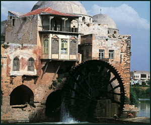
Noria - Hama - Syria
- Copyright © 2012 - All Rights Reserved -
- Islamic Civilization