|
The Heated Battlefield of the History of Maritime Discoveries
Western history is a true battlefield when it comes to certain
decisive advances in science and civilisation. The reason being
that Western historians suppress the real author of such
advances, the Muslims, and then, in seeking to substitute
alternative authors, each
group of historians comes up with explanations, which
hold no historical ground.[1]
The following highlights this matter.
A
large group of historians categorically assert that Ptolemy’s
science was central to maritime discoveries, that between
Ptolemy and the 14th century there was hardly any
advance in the field, and that the only map of the
This
is fundamentally wrong, the above sections on mapping, and
earlier chapter on astronomy have shown how Ptolemy’s maps and
measurements were wrong, and that every Islamic scholar
corrected his measurements. Thorndike, who has studied the
matter comprehensively, rightly concludes that Ptolemy’s
geography:
‘Consists largely of lists of ancient place names, many of which
cannot be identified or located with any assurance and are of
purely historical and linguistic interest. Moreover, Ptolemy had
made the Mediterranean
Sea too short[3]
by one third (Thorndike should have said too long), whereas one
of the medieval portolani is more accurate than any other map of
the
Like
Thorndike, a substantial group of Western scholarship is very
critical of Ptolemy. Parry, for instance, says:
‘In
the process of Reconnaissance, explorers by sea, pushing rashly
out in the world of the unknown, but for Ptolemy, and finding it
bigger and more varied than they expected, began first to doubt
Ptolemy, then to prove him wrong in many particulars, and
finally to draw on maps and globes a new and more convincing
picture. Similarly, but independently, Copernicus and his
successors, studying their Ptolemy and watching the heavens,
noticed certain celestial phenomena which Ptolemy’s theories
failed adequately to explain. They began timidly and
tentatively, first, to question, then to dismantle the
Aristotelian geocentric scheme of the universe, and to postulate
a heliocentric system in its place. In both studies, the whole
progress from deferential acceptance to doubt, from doubt to
discard and replacement, took many years. Eventually in all
branches of science, Reconnaissance became Revolution.’[5]
This
is a thorough refutation of Ptolemy’s contribution to maritime
discoveries by Parry, but his account, just like the rest of his
counterparts, includes many fallacies and distortions, too.
First, as this section will show below, the seas and oceans
hardly remained unknown between the time of Ptolemy and the
‘Renaissance’ as Parry tells us. Secondly, Ptolemy as was shown
in the preceding heading was amply corrected centuries before
the men of the Renaissance. Had Parry also, however briefly,
consulted a work by Wright, four decades earlier than his, he
would have found that amongst the followers of Muslim
geographers/astronomers was Raymond of Marseilles (fl 1140s). In
the preamble to a set of tables for
The
material to correct Ptolemy’s maps was available centuries
before the Renaissance.
Furthermore, a vast knowledge of Muslim geography, in its
diverse forms, had already impacted on Western Christian
knowledge in the Middle and Later Middle Ages. Without going
into detail, Roger Bacon (1220-1294), the author of Opus
Majus, quoted Muslim authorities in great abundance,
especially Abu M’ashar, al-Farghani, Al-Battani
,
Al-Zarqali, etc, and reproduced their ideas on the planetary
system, ocean tides, phases of the moon, the calculation of
latitudes and longitudes, and their conception of the ‘Cupola of
the Earth,’ or Arin[7]
(the word Arin is a misreading of the Arabic transliteration of
the Indian town Ujjiyaini).[8]
Cardinal Pierre d’Ailly (1410) also quotes the Arin theory in
his Imago Mundi, and it was this work which inspired Christopher
Columbus in his view of the shape of the earth as a pear, and so
that in the western hemisphere, opposite ‘the world summit,’
which he located somewhere near the mouth of River Orinoco.[9]
This was one of the many ways Muslim learning impacted on the
discovery of the
With
regard to Copernicus, it has already been amply shown that his
inspiration was from the 13th century Muslim
astronomers such as Ibn al-Shatir of
Another group of ‘historians’ steps in, and delivers us another
set of explanations for the maritime discoveries. Chaunu, for
instance, says:
‘All
this unconscious preparation for discovery resulted with the
amazing intellectual changes which took place at the end of the
12th century. It followed from the rediscovery of
ancient science and then its outstripping by the use of
Aristotelian method.’[12]
This
is fundamentally ridiculous to say the least, for one can ask:
why did neither
Another group of ‘historians’ tells us that all maritime
discoveries stem from the recovery in the 12th
century of Greek ship construction techniques after such
techniques had been lost for over ten centuries. Casson, thus,
gives ‘the irrefutable proof’ of Greek use of lateen sail
through the evidence of a 4th century piece of mosaic
which seems to show a Greek lateen rigged boat.[13]
This
point brings us, again, to the inexhaustible list of items and
scientific achievements, possibly hundreds of them, lost for
over ten centuries, before, by chance, all were rediscovered by
miracle in the crucial 12th century, the ridiculous
view held by many, not to mention the other piece of poor
‘scholarship,’ that a piece of mosaic could be evidence enough
to build a whole theory around it.
Then
we have the Portuguese group of nautical geographers who tell us
that none of what the other Western historians say is right;
that instead, maritime discoveries are owed to
‘The
Portuguese were the designers and founders of nautical science
in the 15th century, and until the first quarter of
the 16th century they were unrivalled by any other
people in its development and progress. From other people they
received, however, the scientific preparation which constituted
the background of their performance. Their merit lay above all
in the fact of giving a practical application to a branch of
scientific knowledge (astronomy, use of the astrolabe..) that
had been used for speculative purposes only, thus solving a
problem on the solution of which depended the progress of
mankind. With the foundation of nautical science- a first step
only in the great age of discovery of which they were the
leading artisans-the Portuguese came to play a leading role in
the Renaissance.’[14]
To
reinforce one of his principal arguments, the Portuguese use of
instruments for practical purposes, Cortesao quotes a Spanish
pilot of the early 17th century:
‘Spaniards, French, English and Dutch owe what they know to the
Portuguese, who taught them how to navigate on the high seas and
in distant regions: to them not only Spain, but the whole of
Europe owes the application of the astrolabe, which the ancient
always used in order to know the movement of stars, to the use
of art of navigation-such a great invention as its consequences
show.’[15]
Cortesao and the Portuguese ‘school’ are very much nearer the
truth than any other group of scholars with regard to nautical
discoveries. And so are the Spaniards, who also insist on the
role of the
Cortesao, for instance, after reminding of one of the usual
myths: ‘Arab pirates from the North Africa
n
coast growing more daring, infesting the Mediterranean
,
keeping navigation in these waters at their mercy,’[16]
adds:
‘Arab geographers had spread the legend that beyond
Of
course Cortesao makes wild statements without providing any
source for either of his assertions, just as he fails to do for
others. Generalisations which are not backed by historical
reality, either. Had Cortesao explored the history of his
country, he would have read of those ‘Arab’ sailors who departed
from his own capital, Lisbon, when it was in Muslim hands, in
the 9th century, in the direction of unknown lands
and, rather than telling of men turning black, instead, provided
good descriptions of lands, including of the Canaries Islands,
which the Portuguese were to only discover for themselves
centuries after Muslim sailors had already described them.[18]
Cortesao also makes a serious mistake, when he says:
‘The
Muslims used astronomical observations for astrology, and it was
specifically for this purpose that it passed into
Again, he is not backing his statements by references, making
generalised assertions, which do not hold scientifically. And he
is also wrong on many accounts. First, how can Cortesao be sure
instruments were ‘never’ used at sea in
[1]
A good instance of this relates to the rise of Provencal
literature and romance. See M R Menocal: The Arabic
Role in Medieval Literary History (University of
Pennsylvania Press, Philadelphia, 1987).
[2]
Commentaries following lecture by R. Almagia at the
Lausanne Congres; in Archives Internationales
d’Histoire des Sciences; vol 1; pp. 237-46, at p.
245.
[3]
Throndike is wrong, Ptolemy made it too long.
[4]
L. Thorndike: Renaissance or Prenaissance; in The
Making of Modern Europe; edited by H. Asubel; Book
One (The Dryden Press; New York; 1951), pp. 60-72. p.63.
[5]
J.H. Parry: The Age of Reconnaissance; op cit;
pp. 14-5.
[6]
Bibliotheque Nationale; Ms. Fonds Latin
; n. 14704; fol 116. col c. in J.K. Wright: Notes on the
Knowledge of latitudes and longitudes in the middle
ages;
[7]
M.S.Z. Alavi: Arab Geography; op cit; p. 111.
[8]
J. H. Kramers: Geography, op cit,
p. 93.
[9]
M.S.Z. Alavi: Arab Geography; op cit; p. 111.
[10]
N. Swerdlow-O.Neugebauer: Mathematical Astronomy in
Copernicus ‘‘De revolutionibus'' (New York, Springer
Verlag, 1984).
[11]
A. Brikenmajer: l’Universite de Cracovie, Centre
International d’Enseignement Astronomique a la fin du
moyen age. In Studia Copernicana, 4; 1972; pp.
483-95; or see: J.B. Korolec: La Premiere reception de
la philosophie Islamique a l’Universite de Cracovie; in
The Introduction of Arabic Philosophy; op cit;
pp. 112-30.
[12]
P. Chaunu: European Expansion in the Later Middle
Ages; tr. by K. Bertram (North Holland Publishing
Company; Amsterdam; 1979), pp 84-5.
[13]
L. Casson: Ships and Seamanship in the Ancient World
(
[14]
A. Cortesao: Nautical Science and the Renaissance; in
ARCHEION; vol 2; pp. 1075-92; at p. 1077.
[15]
Thome Cano in Arte para fabricar, fortificar y
apareiar naos de Guerra y mercantes….
(
[16]
A. Cortesao: Nautical; p. 1080.
[17]
Ibid.
[18]
See summary of these voyages of discovery in D.M.
Dunlop: Arab Civilisation; op cit; pp.160 ff.
[19]
A. Cortesao: Nautical; p. 1084.
[20]
Ibid; p. 1085.
[21]
See, for instance, G. Sarton: Introduction; op
cit, on the countless instances of shared knowledge
between the Muslim East and West.
[22]
A. Cortesao: Nautical; op cit; p. 1085.
[23]
H.N. Saunders: The Astrolabe; op cit;
p.7. W. Hartner, ‘‘The Principle and use of the
astrolabe,'' op cit; and J.D. North: ‘‘The Astrolabe,''
op cit.
[24]
In T. Glick: Islamic and Christian Spain; op cit;
p. 228.
[25]
Ibid.
[26]
See:
[27]
A. Cortesao: Nautical; op cit;
p. 1086.
[28]
W. Hartner, "Asturlâb," Encyclopaedia of Islam;
New series; I: 722-8; J. Millás Vallicrosa:
"Introducción del cuadrante con cursor"; M.
Destombes, "Diffusion des instruments scientifiques,"
pp. 36-38, 41;
Salvador García Franco, Catálogo crítico de
astrolabios existentes en España (Madrid: C.S.I.C.,
1945); etc.. all in T. Glick: Islamic, op cit; p.
267.
[29]
H.J.J. Winter: Notes on al Kitab Suwar al-Kawakib (of
al-Sufi); in ARCHEION; Vol 8; pp. 126-33; esp.
pp. 130-1.
[30]
A. Cortesao: Nautical; op cit; p. 1086.
[31]
G. Sarton: Introduction; Volume III; op cit;
p.61.
[32]
A. Cortesao: Nautical; op cit; p. 1086.
[33]
Refer to following heading; see also, M. Destombes
criticism of G. Baujouan; E. Poulle: Les Origines de la
navigation astronomique au 14 em et 15em siecle; in Le
Navire et l’Economie maritime du 15em au 18em siecles;
Paris; 1957.
Rev by M. Destombes; ARCHEION;
13; pp. 144-5. at p. 144.
[34]
A. Cortesao: Nautical; op cit; p. 1087. |
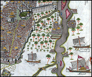
Cairo - Piri reis - Book of Navigation
- Copyright © 2012 - All Rights Reserved -
- Islamic Civilization