Geography
|
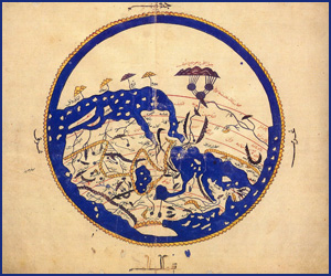
The
interest given to Islamic geography and nautical sciences by a
large number of authors mirrors its importance. Whether human
geography,[1]
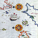
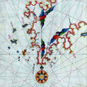
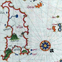
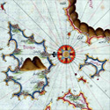
or nautical sciences,[2]
or other branches of the subject,[3]
there is ample information and a great choice of reference
material. General syntheses by one single author have also been
abundant; a good one is by De Vaux,[4]
and another is by Khratchokovsky.[5]
The latter is 919 pages long, covering the works of 260 Muslim
geographers, and it includes a bibliography of 54 pages, a work
so thorough that it took its author forty years to complete ‘A
work of a lifetime gifted to us,’ says M. Canard in his review
of it.[6]
However, the abundance of works does not mean the matter is as
adequately dealt with as one would wish. As usual, some crucial
issues have remained obscured such as, for instance, the impact
of Islamic nautical science on subsequent 15th–16th
century discoveries. Another flaw is the constant attribution of
Islamic geographical achievements to Greek predecessors even if
such Greek influence limited itself to Ptolemy’s writing,
focusing on place locations, with little or no contribution to
other branches of the subject such as human geography or
nautical science; this narrow focus is wrongly widened to
generalised influence on Muslim geography.
The other problem is the tendency amongst many to inflate the
works of the 10th century geographer al-Mas’udi
(912-957) and set aside the rest.[7]
Al-Mas’udi’s Muruj al-Dhahab wa Ma'adin al-Jawhar
(Meadows of Gold and Mines of Gems) at best can compare to the
works of the likes of al-Idrisi, al-Biruni, Yaqut, and
al-Muqaddasi.[8]
Other geographers accomplished much more. Al-Biruni
(973-1050), for
instance, wrote the best material on the subject; his
accomplishments, as briefly outlined here, included creating the
branch of mathematical
geography, determining with remarkable precision the coordinates
of a number of places, introducing a simplified method of
stereographic projection, describing India
, explaining the occurrence of natural springs and of artificial
wells by laws of hydrostatics, reflections on the Indus valley,
such as that it was probably an ancient sea-basin which had
gradually filed up with alluviums,[9]
and
scientific comments on the distribution of land and water on the
face of the globe.[10]
Many
authors dealing with Islamic geography, such as Ronan, also hold
that Muslim geography declined after al-Masudi's death, which is
incorrect. A brief look at any source shows that Muslim
geography, in fact, peaked following al-Masudi's death. Ronan,
like Renan, also blames the decline of both Muslim geography and
society on the ‘heavy hand of Islam' in the 13th
century[11]
(an issue to be considered in the final part of this work),
whilst ignoring that the Muslim land in the 13th
century was devastated by invasions (crusades, Mongols, the loss
of Muslim Spain, etc,) which destroyed scholarship, and killed
geographical inquiry. One geographer, Yaqut, for instance, in
the wake of the bloody Mongol devastation of eastern Islam in
1220 had to flee the city of
Another problem relates to some modern studies of Muslim science
and civilisation, which are very poor compared to those that
preceded them up to a century; the article by Grosset Grange and
H. Rouquette on Islamic nautical science in Rashed’s
encyclopaedia of Arabic science,[13]
for instance, is of very poor quality compared to works such as
by Ferrand which are nearly a century older.[14]
Another problem relates to the contradictory nature of writing,
which one finds in the same author, censuring and praising
Islamic science at once. Hence, Tolmacheva, for instance, says:
‘It
is thus obvious that while Islamic geography faithfully
preserved ancient and foreign geographical concepts, it failed
to produce its own form or to develop a viable synthesis of the
old forms with the-new information. Its chief value, then, is
not in the field of theory, but in the facts it accumulated,
particularly because the total volume of preserved data is very
considerable. Its significance goes beyond geography into other
areas of knowledge, at least in part because of the prevalence
of descriptive geography… and it was also customary to discuss
other sciences in the introductions to geographical works. For
some parts of the world, or certain periods of their history,
medieval Islamic geographers provide major, if not the only,
sources of information. Their works are thus invaluable and
often indispensable to the study of history and historical
ethnography, as well as historical geography and the history of
science.’[15]
From
what has just preceded, it becomes, thus, necessary to approach
the subject from a more searching perspective.
[1]
See for instance:
-G. Ferrand: Relations de Voyages et textes
geographiques
Arabes, Persans and Turks
relatifs a
l’Extreme orient du VIIem au XVIIIem Siecles
(Ernest Leroux, Paris, 1913-4.)
G. Ferrand: tr and ed: Voyage du marchand Arabe
Sulayman en Inde et en Chine redige en 851… Paris;
Edition Bossard; Vol vii; Les Classiques de l’Orient.
-A.Miquel: La Geography Humaine du Monde Musulman;
4 vols (Paris; 1967).
-C.de La Ronciere: La Decouverte de l’Afrique au
Moyen Age; Vol 1; Published as Vol 5 of the memoires
de la Societe Royale de Geography d’Egypte (Cairo
; 1924).
[2]
L.Bagrow: The
Vasco de Gama's Pilot (
-G. Ferrand:
Instructions Nautiques et Routiers Arabes et Portugais
des XV et XVI Siecles, 3 Vols (Paris, 1921-)
-H. Grosset-Grange: La Science nautique Arabe,
Jeune Marine,
1977-9, 16-29 (except 22).
----- Glossaire
nautique Arabe ancien et moderne de l'Ocean Indien
(Paris, 1993).
-G.F. Hourani:
Arab Seafaring in the Indian Ocean
in Ancient and
Early Medieval Times
(
-G. Tibbetts:
Arab Navigation
in the
[3]A.F.L.
Beeston: Idrisi’s account of the
A.Dallal: Al-Biruni
on Climate in
Archives Internationales des Sciences; 34; pp. 3-18.
J.B. Harley and D. Woodward ed: History of
Cartography in Prehistoric, Ancient and Medieval Europe,
and the Mediterranean
;
A. Jaubert: La Geographie d’Idrisi (Paris;
1836-40; Reprinted Amsterdam; 1975).
E.S. Kennedy: A Commentary upon Biruni’s Kitab tawhid
al-Amakin; an 11th Century Treatise on
Mathematical Geography (
E.S and M.H. Kennedy: Geographical Coordinates of
Localities from Islamic Sources (
O.J and A.M. Tuulio Tallgren: Idrisi, la Finlande et
les autres pays baltiques Orientaux; Helsinki; 1930.
[4]
Barron Carra de Vaux: Les Penseurs de l’Islam, op
cit; vol
ii; chaps 1-3; pp 1-100.
[5]
I.J. Krckovskij: Izbrannye Socinenja (chosen
works); Vol 4 (
[6]
In Arabica, Vol 5 (1958,
[7]
Such as C. Ronan: The Arabian, op cit, pp 229-33.
[8]
Al-Muqaddasi, according to Sprenger, is the greatest
geographer ever. Cited by Kramers, ‘La literature
geographique classique des Musulmans', Analecta
Orientalia, i (
[9]
G. Sarton: Introduction; Vol 1; op cit;
p.699.
[10]
In the printed version of Kitab al-tafhim, edited
and translated by R. R. Wright: The Book of
Instruction in the Elements of the Art of Astrology
(London; Luzac; 1934), pp. 120-4. The map that
accompanies it on p. 124 shows for the first time this
new conception of the world. In G.R. Tibbetts: Later
Cartographic Developments; in History of
Cartography;( J.B. Harley and D. Woodward ed;) op
cit; pp. 137-55;
p.141.
[11]
C. Ronan: The Arabian; op cit; p.
230.
[12]
W. Durant: The Age of Faith; op cit; p. 329.
[13]
H. Grosset Grange (in collaboration with Henri
Rouquette): Arabic Nautical Science,
in Encyclopaedia (Rashed ed);
op cit; pp 202-42.
[14]
G. Ferrand: Relations de Voyages et textes; op
cit.
[15]
M.A. Tolmacheva: Geography and cartography: Islamic;
Dictionary of the Middle Ages; Vol 5; pp 391-5; at
p. 394. |